
CASTILLON-EN-AUGE CHURCHYARD
Calvados
France
GPS Coordinates: Latitude: 49.03131, Longitude: 0.09007
Location Information
Castillon-en-Auge is a village and commune 23 miles (38 kilometres) south-east of Caen, 11 miles (18 kilometres) south-west of Lisieux, and 6 miles (10 kilometres) east of St. Pierre-sur-Dives. This is a small town 12 kilometres south of the N.13 Caen to Lisieux road. Castillon-en-Auge is only 2 miles (3 kilometres) north of St. Marguerite-de-Viette.
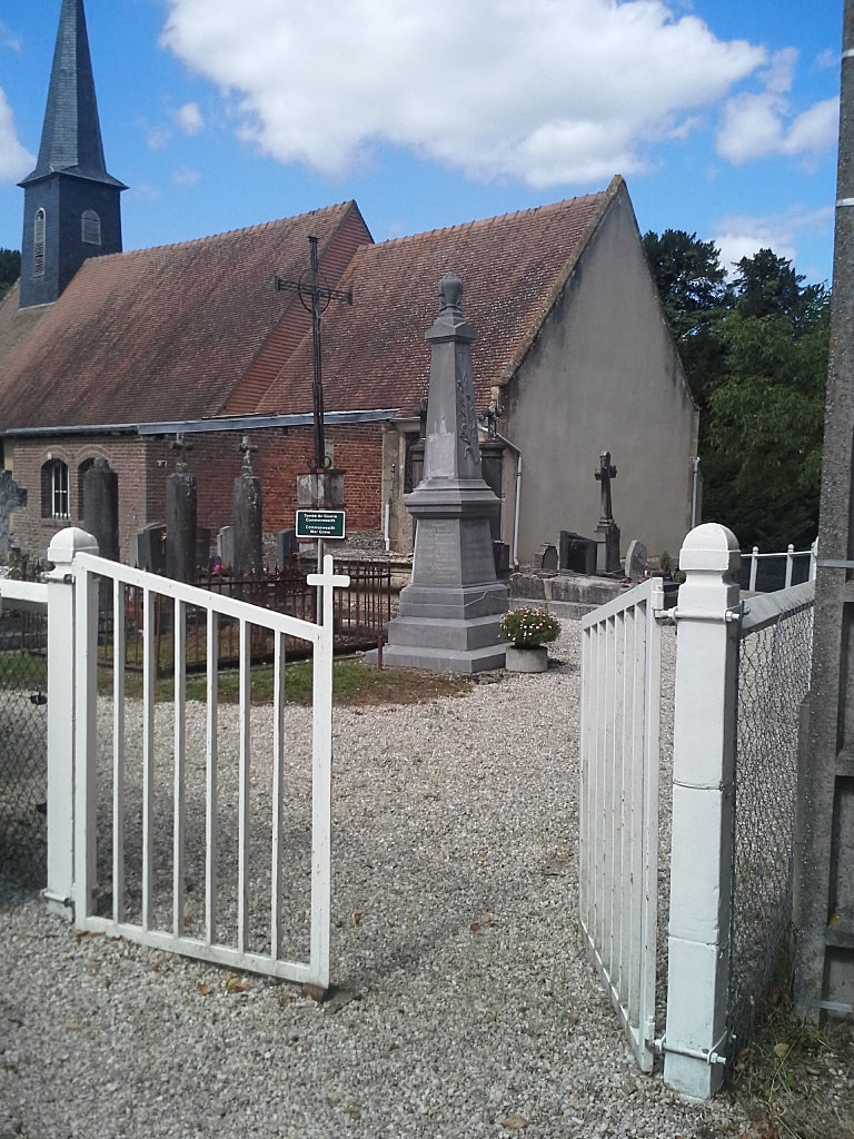
There is 1 Commonwealth burial of the 1939-1945 war here, 12 yards north-west of the west door of the church.
Churchyard pictures used with the permission of the Commonwealth War Graves Commission
Castillon-en-Auge is a village and commune 23 miles (38 kilometres) south-east of Caen, 11 miles (18 kilometres) south-west of Lisieux, and 6 miles (10 kilometres) east of St. Pierre-sur-Dives. This is a small town 12 kilometres south of the N.13 Caen to Lisieux road. Castillon-en-Auge is only 2 miles (3 kilometres) north of St. Marguerite-de-Viette.
There is 1 Commonwealth burial of the 1939-1945 war here, 12 yards north-west of the west door of the church.
Churchyard pictures used with the permission of the Commonwealth War Graves Commission
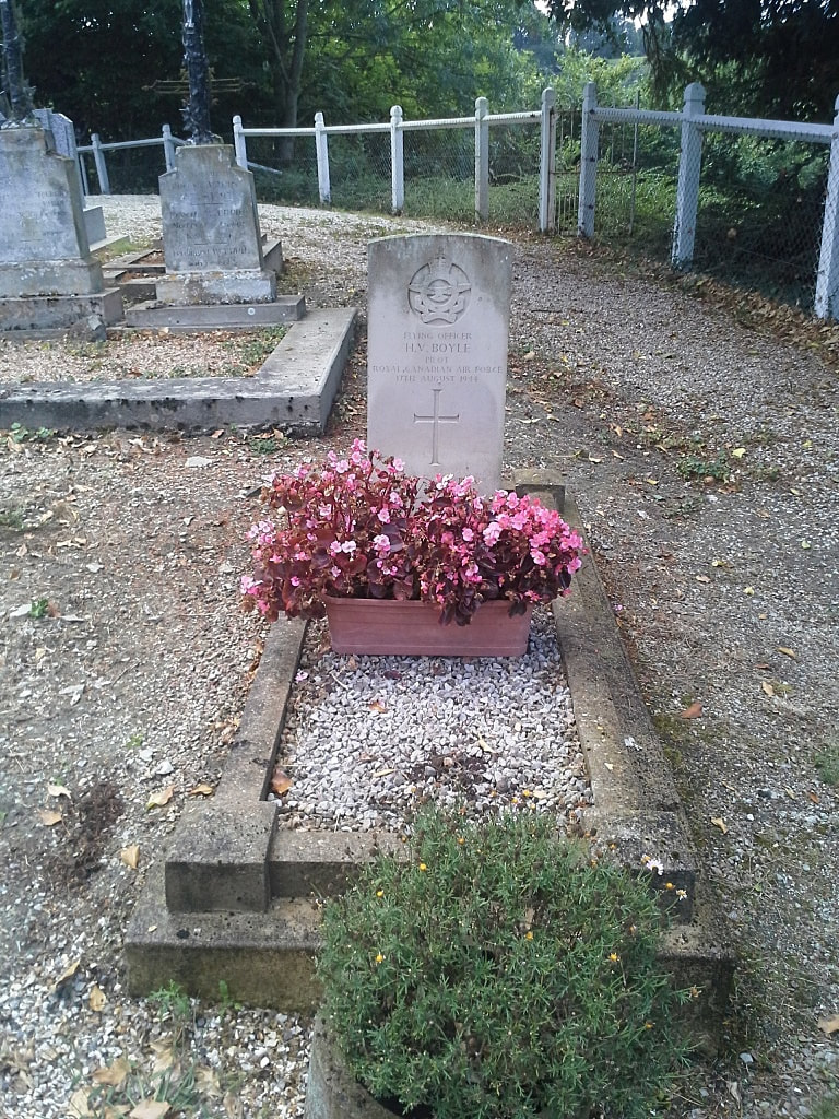
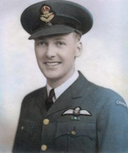
J/17745 Flying Officer
Harry Vern Boyle
Pilot in 403 Squadron, Royal Canadian Air Force
17th August 1944.
Harry Vern Boyle
Pilot in 403 Squadron, Royal Canadian Air Force
17th August 1944.


