ST. MACLOU-DE-FOLLEVILLE CHURCHYARD
Seine-Maritime
France
GPS Coordinates: Latitude: 49.67978, Longitude: 1.10714
Location Information
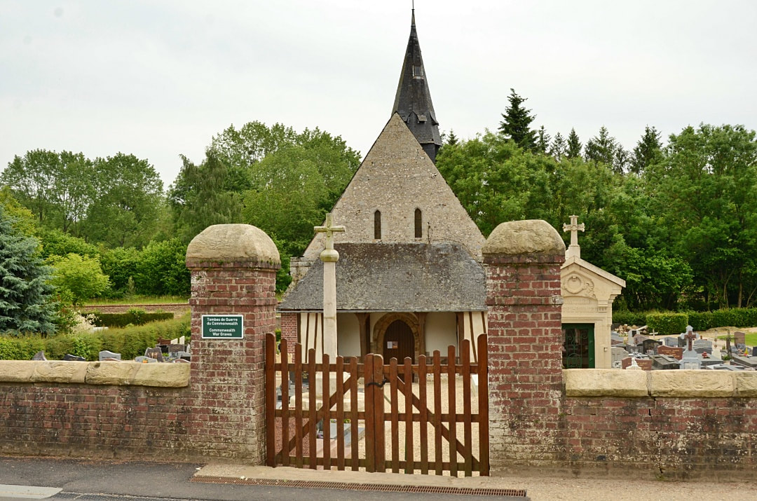
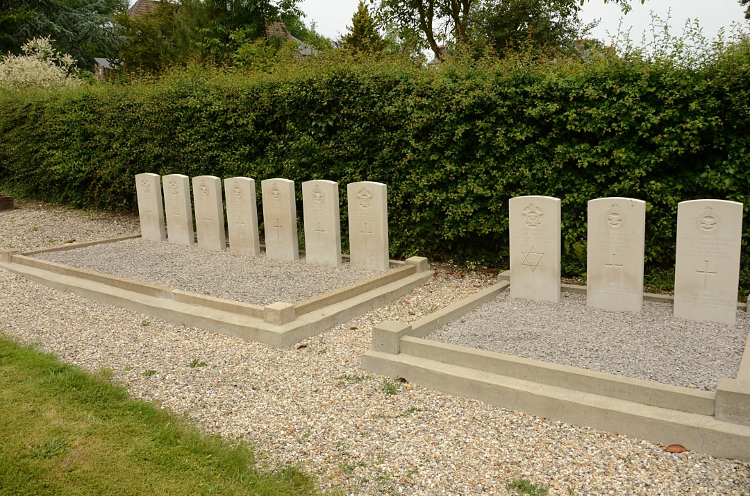
St. Maclou-de-Folleville is a village and commune 30 kilometres north of Rouen, and 6 kilometres east of Totes, a small town where the N.29 Le Havre to Amiens road crosses the N.27 road from Rouen to Dieppe. The village lies north of the N.29 road, and is on the D.57 road. There are bus services on the N.29 road between Le Havre and Neufchatel, and on the N.27 road between Rouen, Totes and Dieppe. The war graves are near the north-east corner of the churchyard.
Historical Information
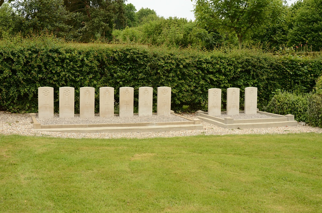
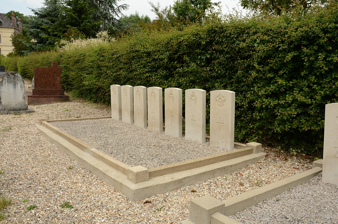
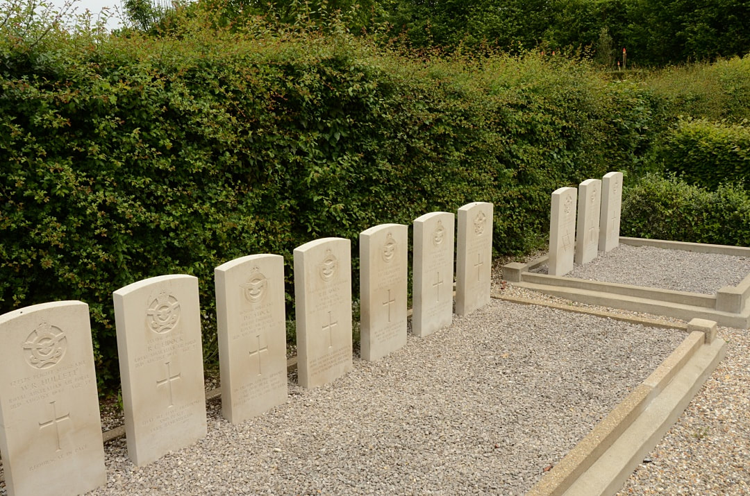
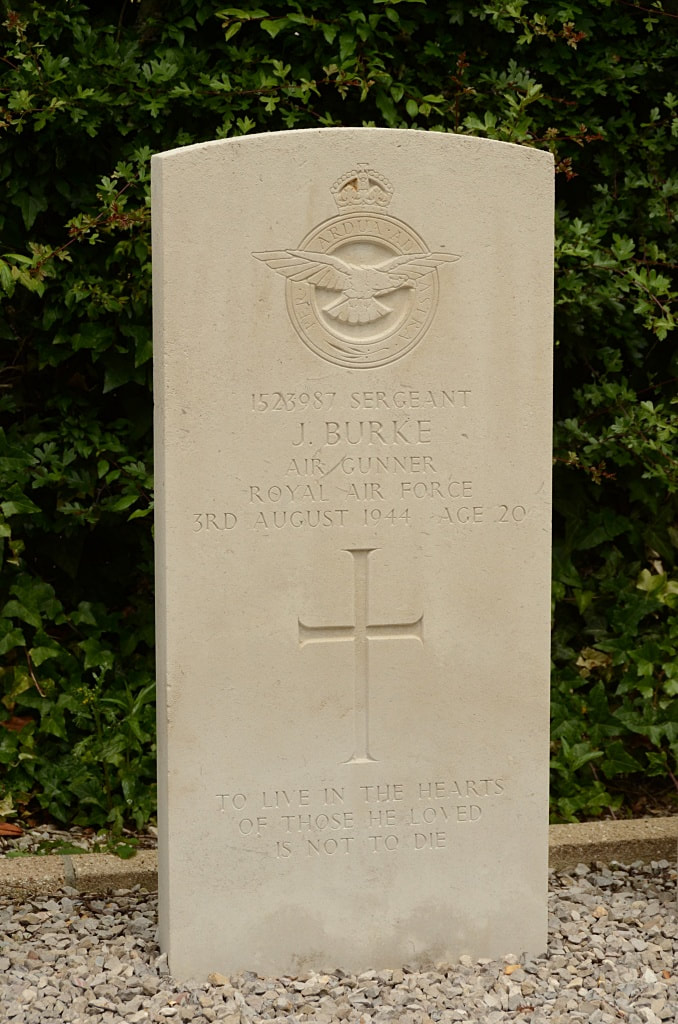
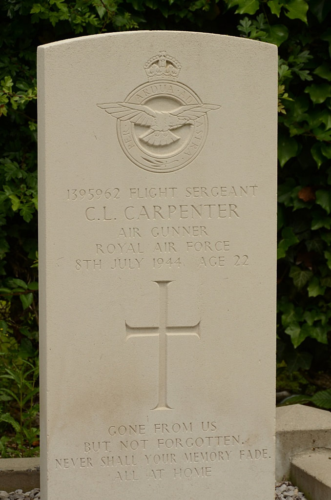
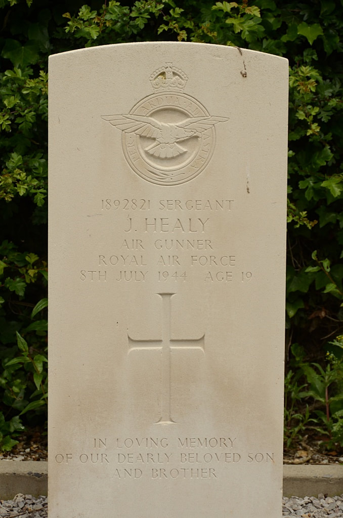
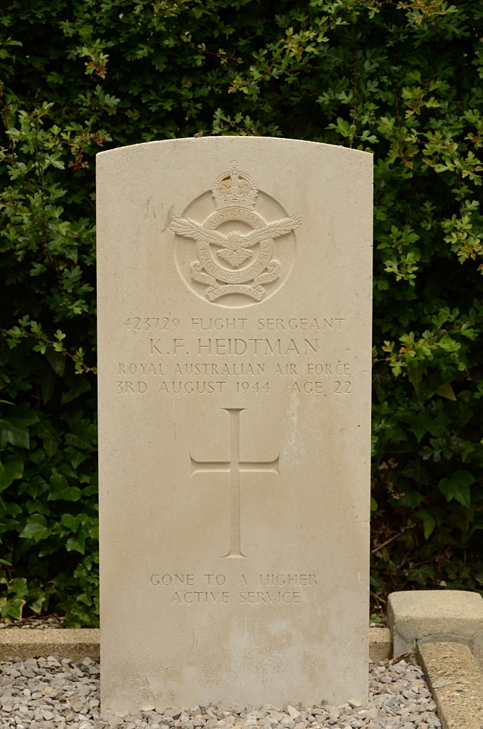
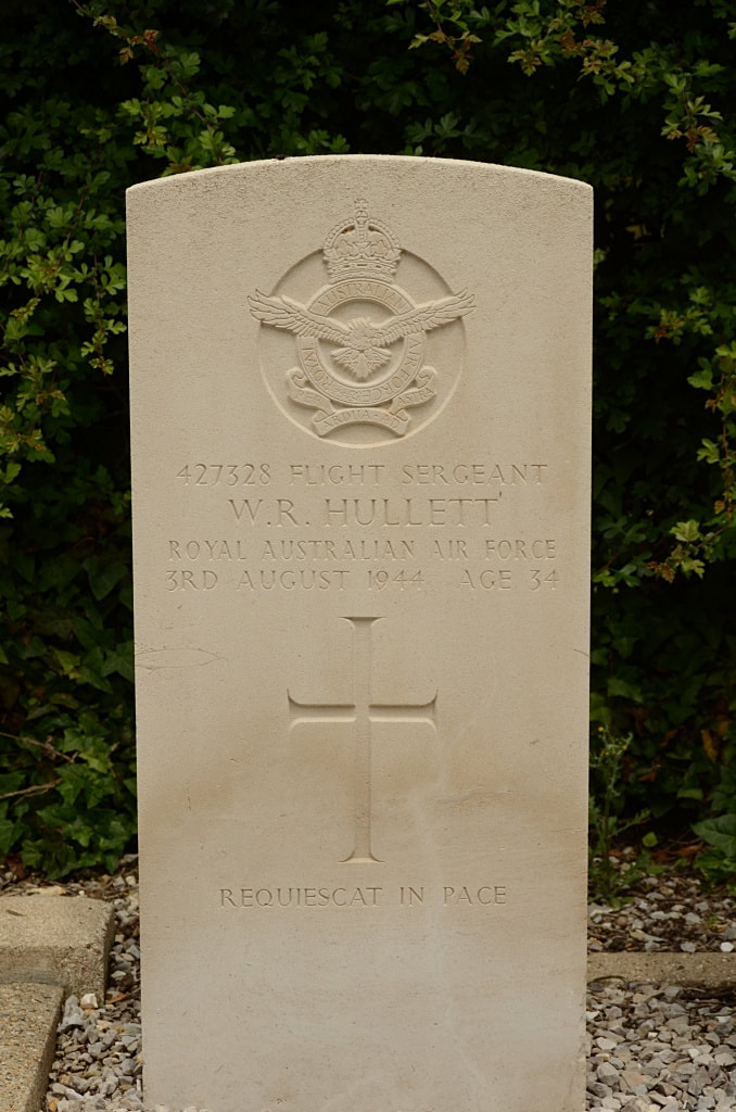
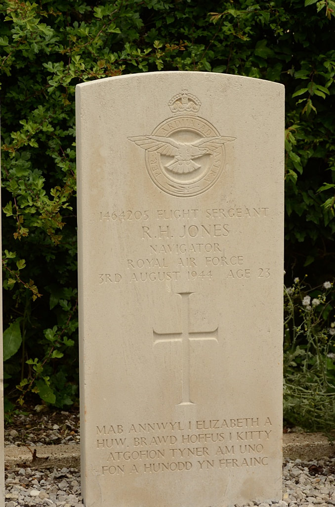
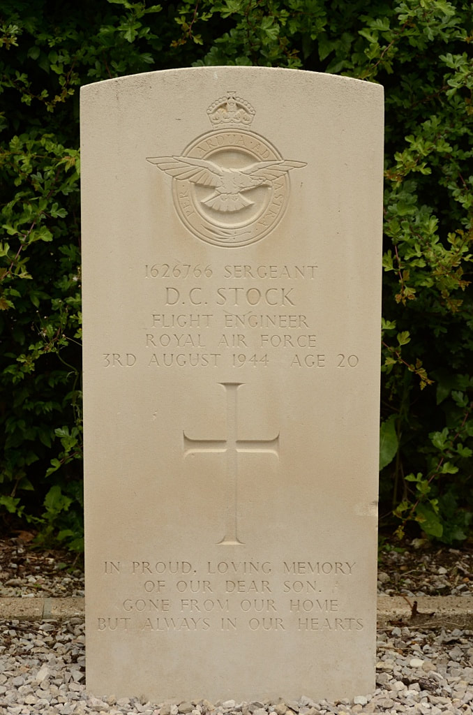
There are now 10, 1939-45 war casualties commemorated in this site.
World War Two Casualties: United Kingdom 6, Australia 4. Total 10.
St. Maclou-de-Folleville is a village and commune 30 kilometres north of Rouen, and 6 kilometres east of Totes, a small town where the N.29 Le Havre to Amiens road crosses the N.27 road from Rouen to Dieppe. The village lies north of the N.29 road, and is on the D.57 road. There are bus services on the N.29 road between Le Havre and Neufchatel, and on the N.27 road between Rouen, Totes and Dieppe. The war graves are near the north-east corner of the churchyard.
Historical Information
There are now 10, 1939-45 war casualties commemorated in this site.
World War Two Casualties: United Kingdom 6, Australia 4. Total 10.