
ST. ANDRÉ-DE-L'EURE COMMUNAL CEMETERY
Eure
France
GPS Coordinates: Latitude: 48.90911, Longitude: 1.27944
Location Information
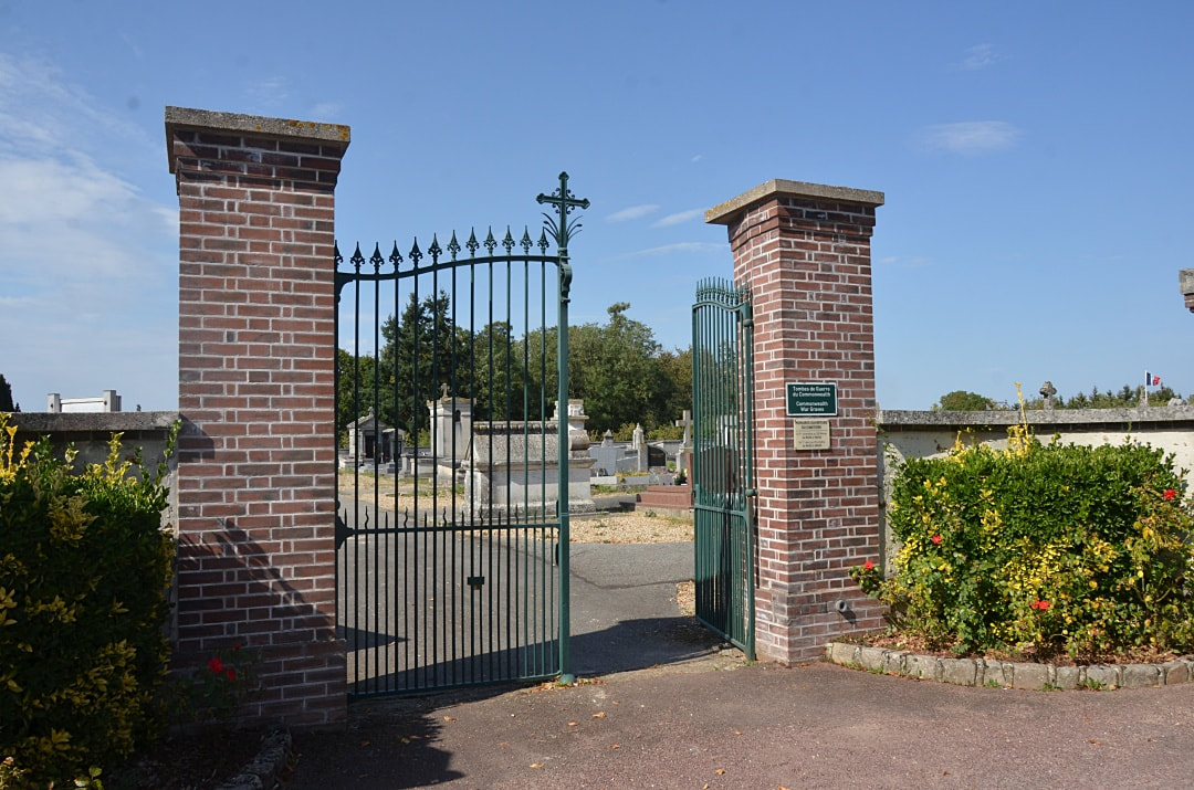
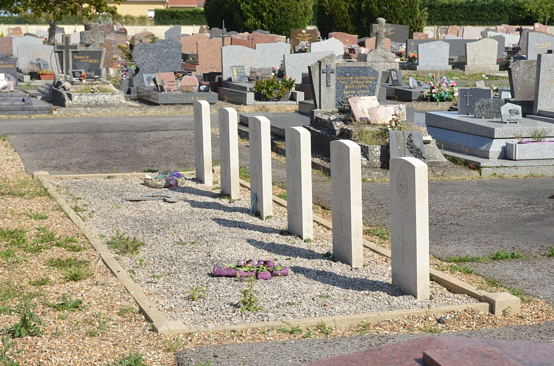
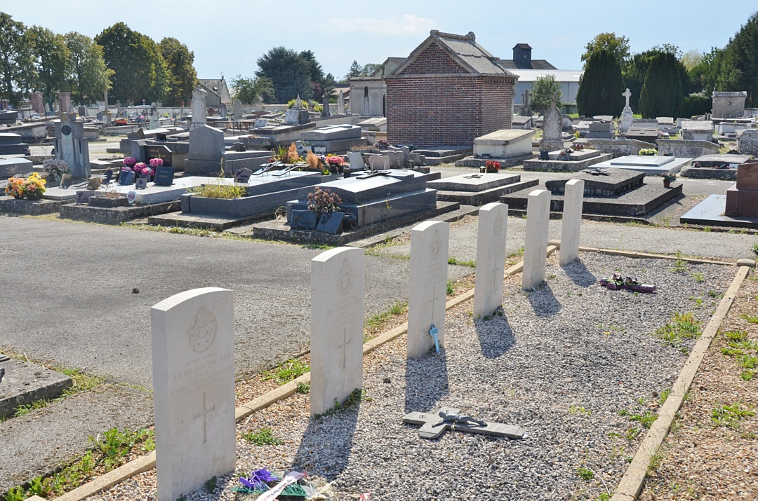
St. André-de-l'Eure is a small town 16 kilometres south-south-east of the town of Évreux. The communal cemetery is on the north-eastern side of the town, on the D.122 road to Foucrainville. There are 6 airmen buried here, 3 from the UK and 3 Canadian.
St. André-de-l'Eure is a small town 16 kilometres south-south-east of the town of Évreux. The communal cemetery is on the north-eastern side of the town, on the D.122 road to Foucrainville. There are 6 airmen buried here, 3 from the UK and 3 Canadian.
Images in gallery below © Johan Pauwels
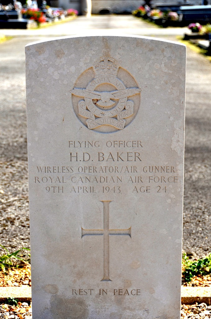
J/15823 Flying Officer
Henry Doulgas Baker
418 Squadron, Royal Canadian Air Force
9th April 1943, aged 24.
Son of George A. Baker and Mary R. Baker, of Neepawa, Manitoba, Canada; husband of Julia Baker.
His headstone bears the inscription "Rest In Peace"
Henry Doulgas Baker
418 Squadron, Royal Canadian Air Force
9th April 1943, aged 24.
Son of George A. Baker and Mary R. Baker, of Neepawa, Manitoba, Canada; husband of Julia Baker.
His headstone bears the inscription "Rest In Peace"
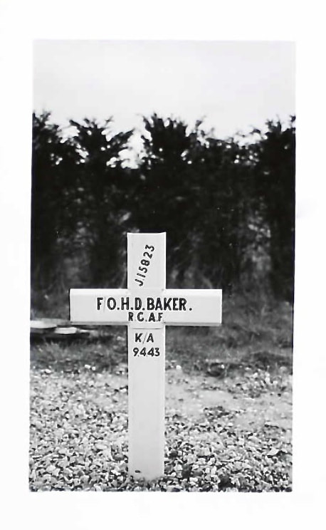
Original Grave Marker
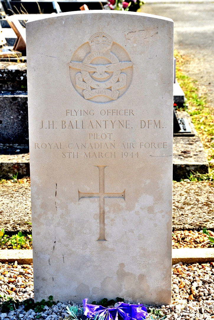
J/16085 Flying Officer
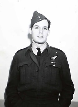
James Hamilton Ballantyne, D. F. M.
403 Squadron, Royal Canadian Air Force
8th March 1944.
Photo of James Ballantyne – PL-13395 - 6 March 1943 - Portrait: Pilot Officer J.H. Ballantyne, J/16085, Toronto, Ont. Pilot Officer James Hamilton Ballantyne, D.F.M. of Toronto who won the Distinguished Flying Medal while he was a flight sergeant serving with the Royal Air Force in the defense of Malta. Son of Mr. and Mrs. J.H.H. Ballantyne, 43 Hendrich avenue, Pilot Officer Ballantyne has destroyed at least five enemy aircraft and damaged others and his citation notes that he "is a most courageous and brave fighter pilot, who has played a worthy part in the defense of Malta."
Flying Officer Ballantyne enlisted in December 1940, and went overseas in September 1941. F/O Ballantyne was an ace, credited with destroying nine and one quarter enemy aircraft. F/O Ballantyne flew with No 229 and 603 Squadrons in Malta and was awarded the D.F.M. for destroying so many aircraft. He was shot down twice by ME-109's, both times landing in the sea and being rescued by the air-sea rescue crews. He flew Mustangs, Typhoons, Hurricanes and Spitfires
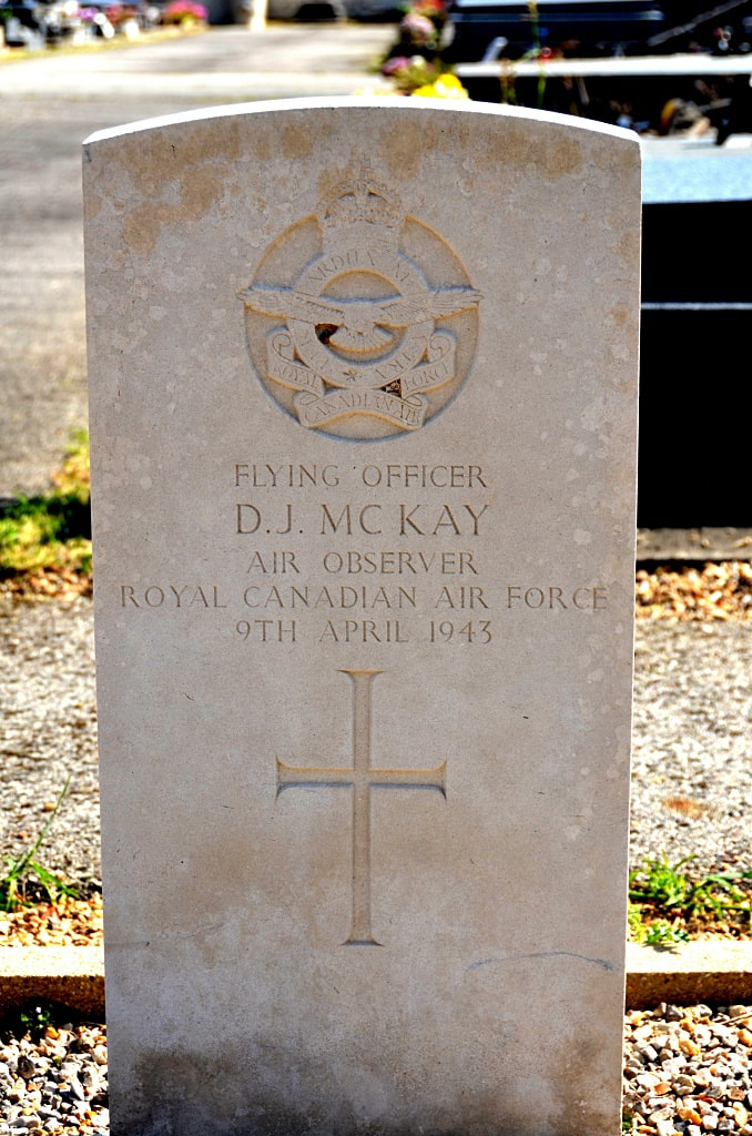
J/18749 Flying Officer
Donald James McKay
418 Squadron, Royal Canadian Air Force
9th April 1943.
Donald James McKay
418 Squadron, Royal Canadian Air Force
9th April 1943.
Other Burial Details
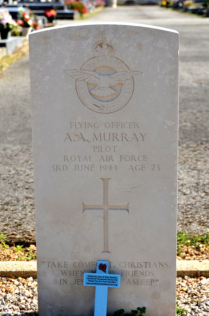
145681 Flying Officer Alexander Archibald Murray, 10 Squadron, Royal Air Force Volunteer Reserve, died 3rd June 1944, aged 23. Son of James Smith Murray and Mary McKillop Murray, of Cleland, Lanarkshire. His headstone bears the inscription "Take Comfort, Christians, When Your Friends In Jesus Fall Asleep"
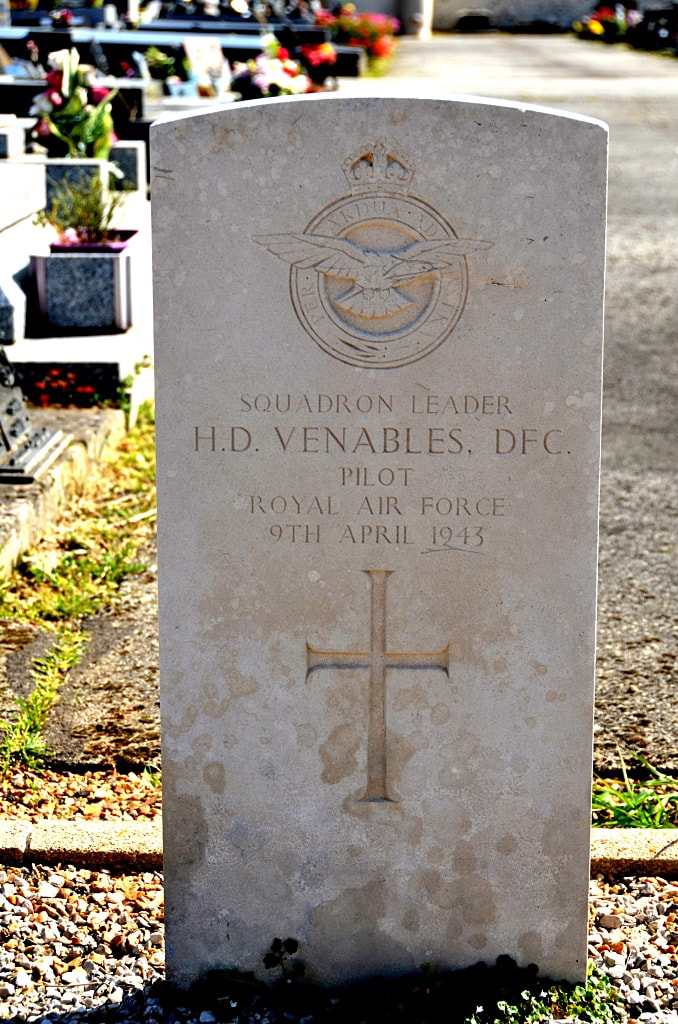
106029 Squadron Leader Hugh Drummond Venables, D. F. C., 418 Squadron, Royal Air Force Volunteer Reserve, died 9th April 1943.
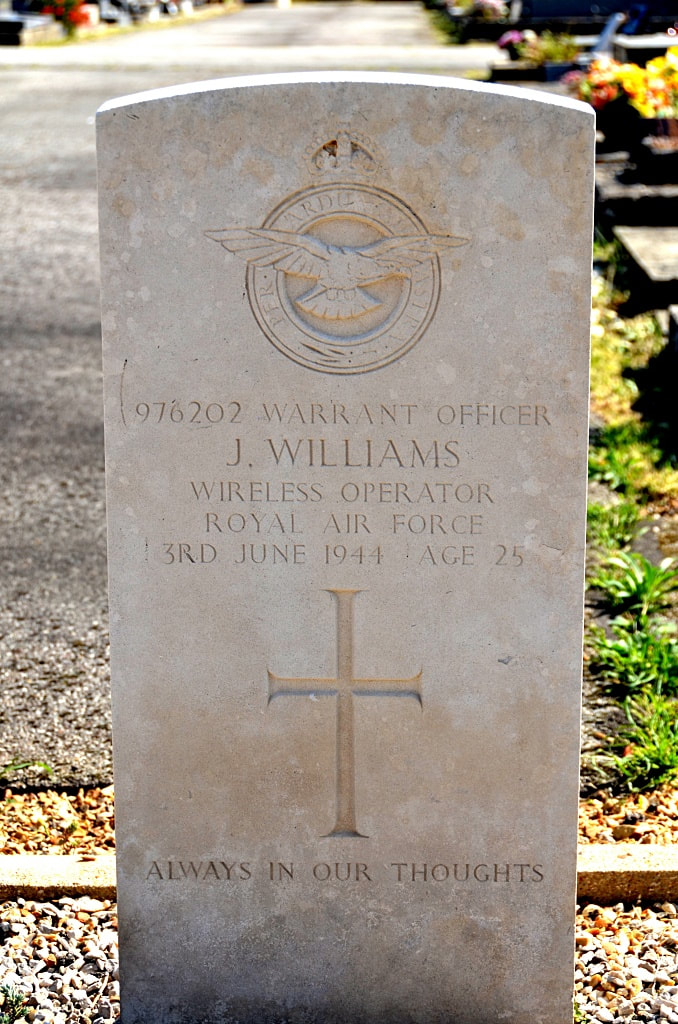
976202 Warrant Officer John Williams, 10 Squadron, Royal Air Force Volunteer Reserve, died 3rd June 1944, aged 25. Son of Frederick Thomas Williams and Mary Ann Williams, of Winton, Bournemouth, Hampshire. His headstone bears the inscription "Always In Our Thoughts"
145681 Flying Officer Alexander Archibald Murray, 10 Squadron, Royal Air Force Volunteer Reserve, died 3rd June 1944, aged 23. Son of James Smith Murray and Mary McKillop Murray, of Cleland, Lanarkshire. His headstone bears the inscription "Take Comfort, Christians, When Your Friends In Jesus Fall Asleep"
106029 Squadron Leader Hugh Drummond Venables, D. F. C., 418 Squadron, Royal Air Force Volunteer Reserve, died 9th April 1943.
976202 Warrant Officer John Williams, 10 Squadron, Royal Air Force Volunteer Reserve, died 3rd June 1944, aged 25. Son of Frederick Thomas Williams and Mary Ann Williams, of Winton, Bournemouth, Hampshire. His headstone bears the inscription "Always In Our Thoughts"
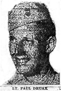
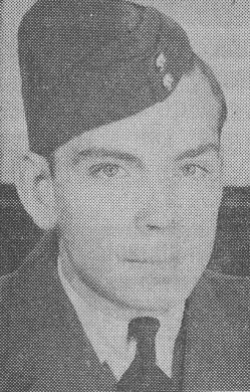
1st Lieutenant
Paul Druax
79th Division, U. S. Army
Purple Heart, Oak Leaf Cluster and Expert Infantry Combat Badge Mother is Mrs. Mary Nolan of Birch Ave. Mr. J. Parriott's database states that he assumed command of 2 platoons for 2 days when the other leader was killed; then he was killed. He was wounded on 3 different occasions and received a Bronze Star with Oak Leaf Cluster for heroic achievement. He had a wife and child.
Son of Paul Louis Druaux and Mary Tricart.
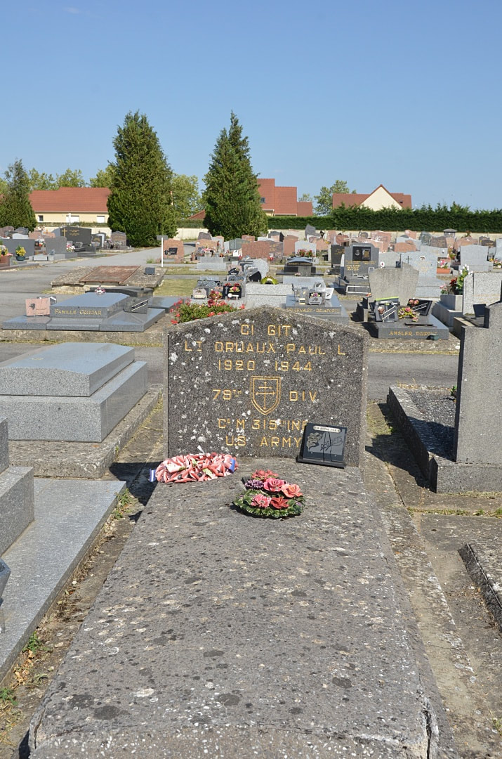
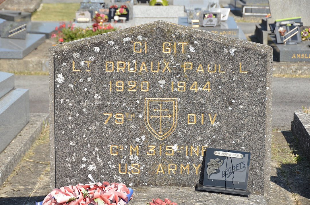
Headstone images above © Johan Pauwels


