OLIZY COMMUNAL CEMETERY
Ardennes
France
GPS Coordinates: Latitude: 49.34271, Longitude: 4.77435
Location Information
Olizy is a village and commune 30 miles (48 kilometres) south of Mezieres and 5 miles (8 kilometres) south-east of Vouziers. Communications are very poor, and the village is most easily reached by taxi from Rethel, a town some 22 miles (36 kilometres) north-west of Olizy on the railway line from Paris to Reims and Mezieres-Charleville. The communal cemetery is 100 yards south of the church, and the grave of a Canadian airman is near the rear hedge.
Olizy is a village and commune 30 miles (48 kilometres) south of Mezieres and 5 miles (8 kilometres) south-east of Vouziers. Communications are very poor, and the village is most easily reached by taxi from Rethel, a town some 22 miles (36 kilometres) north-west of Olizy on the railway line from Paris to Reims and Mezieres-Charleville. The communal cemetery is 100 yards south of the church, and the grave of a Canadian airman is near the rear hedge.

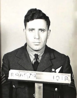
J/86139 Pilot Officer
Henri Edouard Dube
Wireless Operator/Air Gunner in 425 Squadron, Royal Canadian Air Force,
8th August 1944.
Henri Edouard Dube
Wireless Operator/Air Gunner in 425 Squadron, Royal Canadian Air Force,
8th August 1944.


