
AIGLEVILLE CHURCHYARD
Eure
France
GPS Coordinates: Latitude: 49.00627, Longitude: 1.41893
Location Information
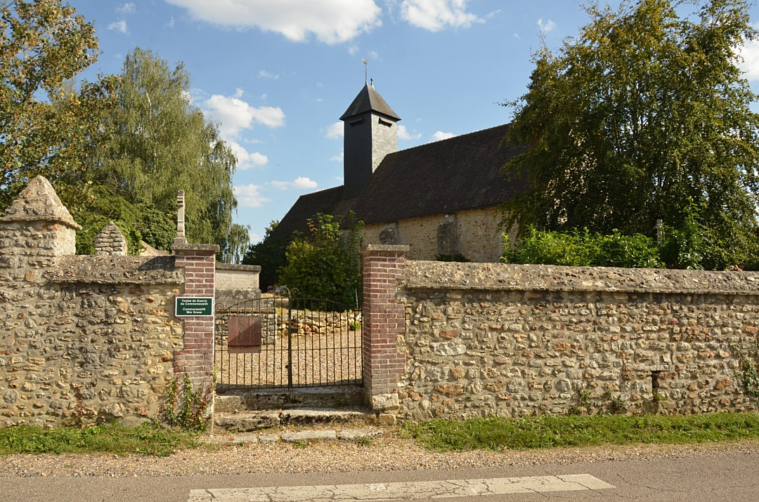
Aigleville is a village and commune in the Department of the Eure. It lies 12.5 miles (20 kilometres) east of Evreux and about 2 miles (3 kilometres) east-south-east of the small town of Pacy-sur-Eure, and south of the N.13 road from Evreux to Bonnieres.
Historical Information
The one British war grave is east of the centre of the church.
Images in gallery below © Johan Pauwels
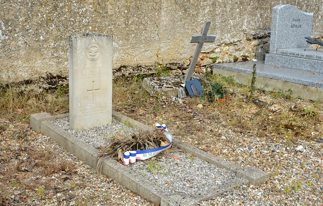
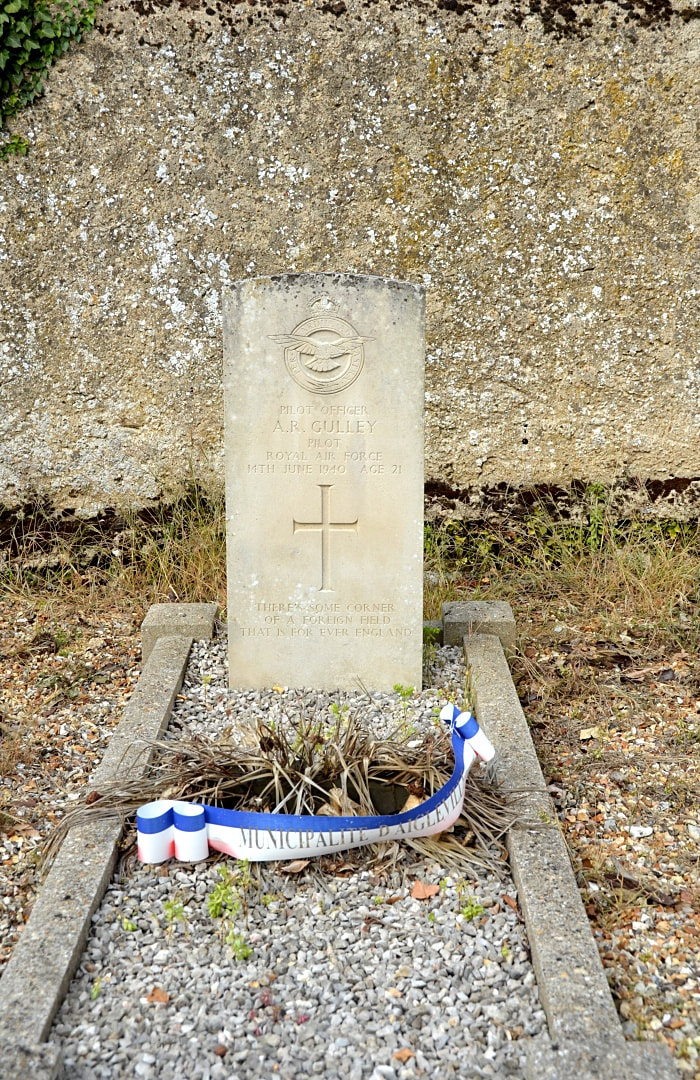
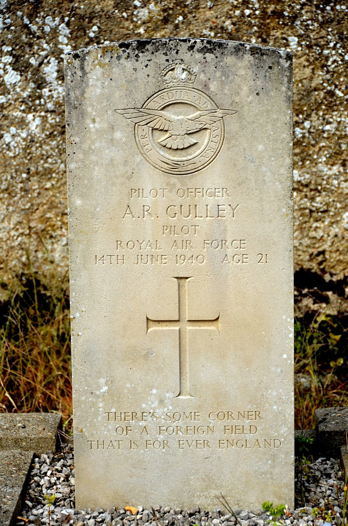
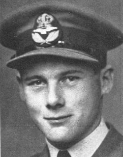
33385 Pilot Officer
Alfred Richard Gulley
Pilot in 150 Squadron, Royal Air Force
14th June 1940, aged 21.
Son of Alfred Clifford and Violet Katharine Langston Gulley, of Parkstone, Dorsetshire.
His headstone bears the inscription "There's Some Corner Of A Foreign Field That Is Forever England"
Alfred Richard Gulley
Pilot in 150 Squadron, Royal Air Force
14th June 1940, aged 21.
Son of Alfred Clifford and Violet Katharine Langston Gulley, of Parkstone, Dorsetshire.
His headstone bears the inscription "There's Some Corner Of A Foreign Field That Is Forever England"


